
Village history
A look at our origins
From the Neolithic age to modern life, people have always been draw to our ancient river valley.
Supporting people throughout time

Collingbourne Ducis is an ancient village in the valley of the River Bourne. Archaeological finds from prehistoric sites, particularly the barrow cemeteries on the downs, show people living in the region from late Neolithic times.
There's also evidence of farming activity on the downland in the late Bronze Age and Romano-British Period. Short stretches of pre-historic ditch appear along the southern and western boundaries. In 1974, important artefacts were found of a burial ground dated from AD 400-450.
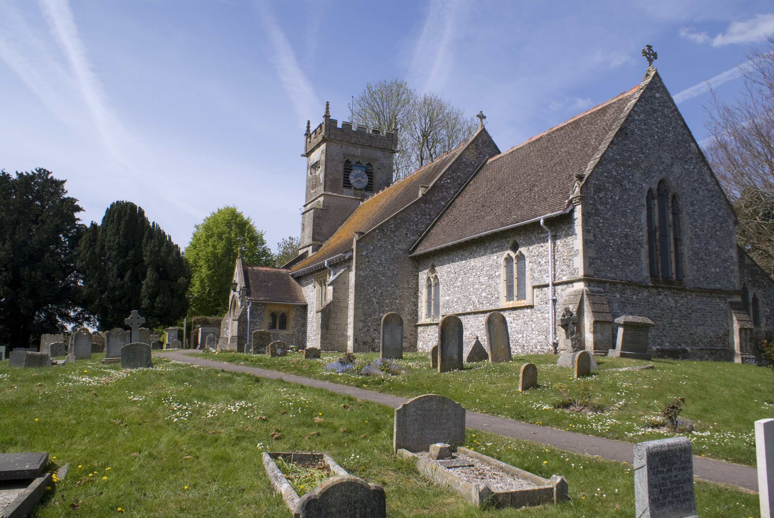
The village is in a Conservation Area and a site of Archaeological importance.
In a Royal charter of AD 903, a distinction was made between the villages of Colengaburn Major (C. Kingston) and Colengaburn Minor (C Ducis). However in 1086, the Domesday Book referred to the valley including both villages as the demesne of a Saxon tribe known as Cola’s people under the single title of Coleburne. This possibly meant “the stream of Cola’s followers”.
Coleburne was actually a group of small settlements. Some were in Kingston and others in Ducis. Of those in the Collingbourne Ducis Conservation Area there were three: St Andrews Church with Church Street, Sunton (Sunton was within Collingbourne Kingston Parish until 1934) and the High Street area.
In 1256 the village was named Collingbourne Earls after the Lord of the Manor, the Earl of Leicester, who also held neighbouring Everleigh. John of Gaunt, who inherited the manor, became the Duke of Lancaster, and the village was thus known as Collingbourne Ducis or Dukes.

In spite of its isolation, in 1353, Collingbourne was granted the right to hold a weekly market and two annual fairs. The last was held in 1792.
In 1536, Henry VIII granted the Lancaster estates to The Protector of Somerset, Edward Seymour (who he later executed in 1554). The lands descended to the Earldom of Ailesbury, the Earl of Cardigan and then back to the Marquis of Ailesbury. It remained part of the great Savernake estate until financial difficulties forced the family to sell the estate in 1929. However, Elizabeth I restored the estates to the Earl of Hertford, Duke of Somerset. From him the lands passed by descent to Charles Lord Bruce through his mother the Countess of Ailesbury.
The village economy relied, until the 20th century, almost entirely upon agriculture and forestry. At the Inclosures in 1773, there were recorded 1,878 acres of fields and 1,313 acres of downland in addition to a further 1000 acres of the village that had previously been inclosed, allotments and roads.

From the early 17th century a small area of pasture south beside the Bourne could be flooded by way of sluice gates to a shallow depth in winter to form small water meadows or ‘ropes’ to grow early spring grass for sheep and lambs. In the same area, there was a large pond, Great Mere, a widening of the Bourne for watering animals crossed by a ford along the Ludgershall Road. In 1969 this was drained and filled.
Until 1773, a windmill stood south east of the village in Mill Lane. Chute Forest extended almost as far west as Collingbourne, where swine herding, nut harvesting, coppicing, cutting and hewing wood were all major activities. Hunting in the forest too was popular with the nobility. For centuries buildings in the village, with the few exceptions such as the church, rectory and school were all agricultural or forest workers’ dwellings, farmhouses, workshops, barns, granaries, stock sheds or stabling.
An Iron Foundry, the Bourne Iron Works, was established in the village by James Rawlings in the 1860s. The family manufactured agriculture implements there until the outbreak of the Second World War. A group of local farmers acquired the premises in 1958 and a company was formed to manufacture milking machines and farming equipment. The company was known as Hosier Farming Systems. There is now a small industrial estate on the site.
The railway
For many years, the village was served by rail. In 1882, The Midland and South-Western Junction Railway Company opened a single track line, passenger station, goods sidings and a weigh bridge at Collingbourne Ducis.
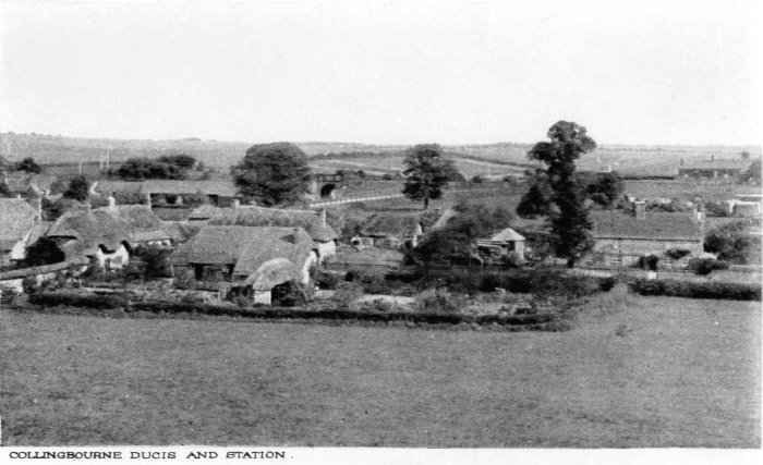
In 1901 and 1902 the line was improved to double track and much used by the military. The company’s route connected Cheltenham to Southampton via Swindon, Marlborough, Ludgershall, Andover and the smaller intermediate stations including the Collingbournes.
In 1961, the line was closed and the track removed. Of the railway only a few installations remain; the station house with a large level former yard reached by a ramped approach off the Cadley Road. The continuous embankment and bridge abutments define the eastern boundary of the Conservation Area. However any development much above ground on the track-bed appears prominently on the skyline in views from the village in the valley below.
The roads
Most of the local lanes and roads originated as un-metalled droveways for sheep and cattle. Chicks Lane /West Hill was a droveway from the western downland. Ludgershall Road was known as Cow Drove.

As for the main roads in the parish, before 1831 the two principal routes leading south towards Andover and Salisbury passed the village by some distance to the to the east and west . The Hungerford to Ludgershall drove road passed the village half a mile to the east and its connection to the village was by Cadley lane at the nearby Shears Inn. To the west the old road from Marlborough to Salisbury was via Easton Royal to Everleigh and across Haxton Down and Bulford.
After 1762, this route was abandoned when a new road was constructed between Everleigh and Ludgershall. In 1772 the Hungerford Road was also turnpiked. At that time most north-south traffic went by way of Shaw Hill and Sunny Hill Down. Only after the Turn pike Act of 1831 was the main route south made via High Street, Church Street and Knap Hill to Southly Bridge and Tidworth. Before that Church Street was peaceful with local traffic only for West Hill and Smallway to outlying farms.